
TOWARDS A JUST LANDSCAPE
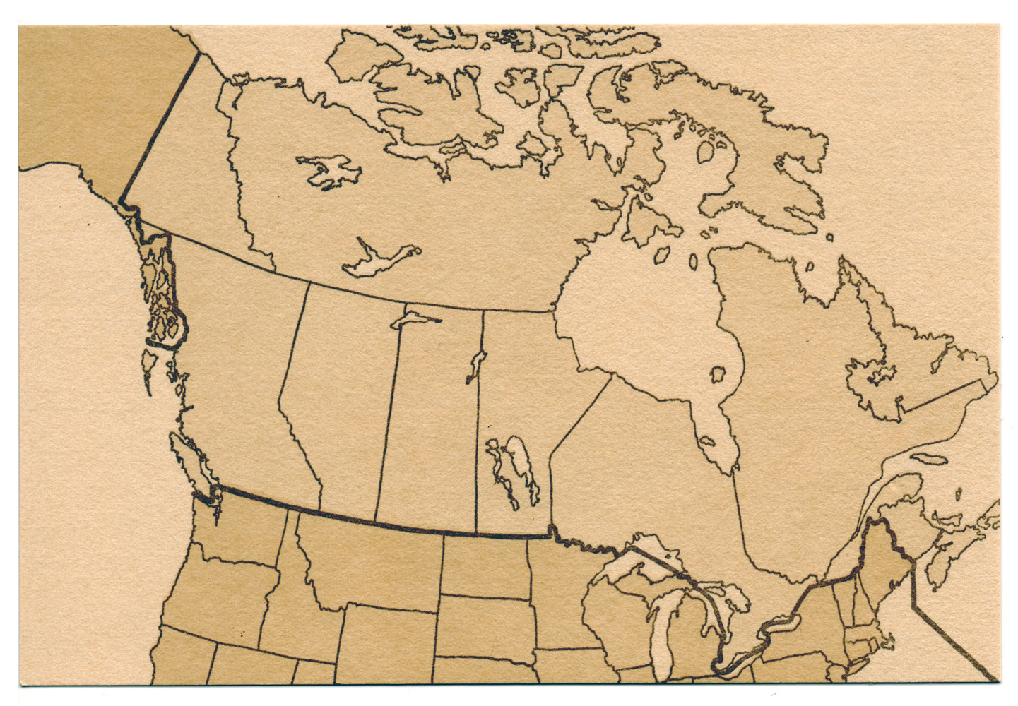
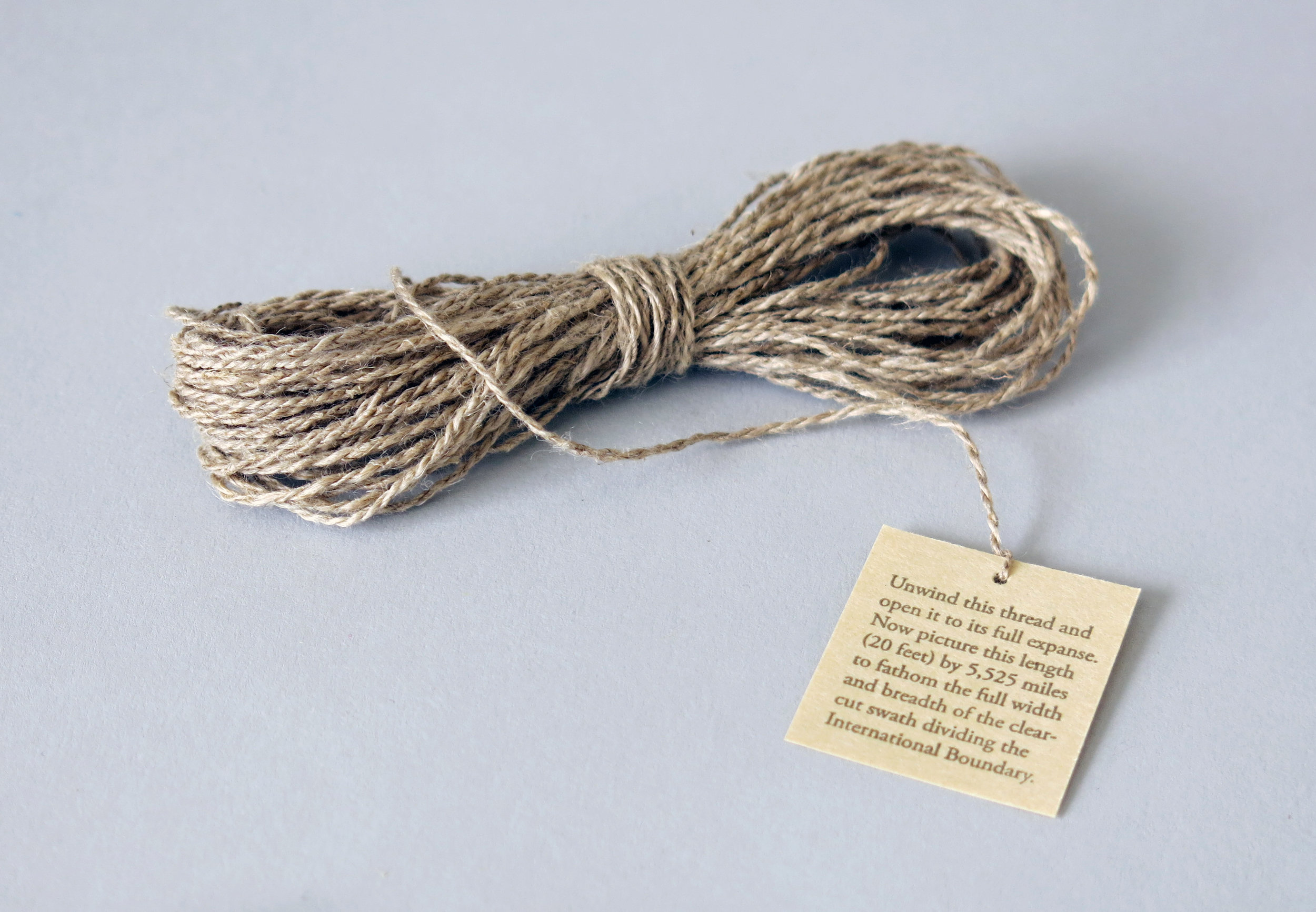
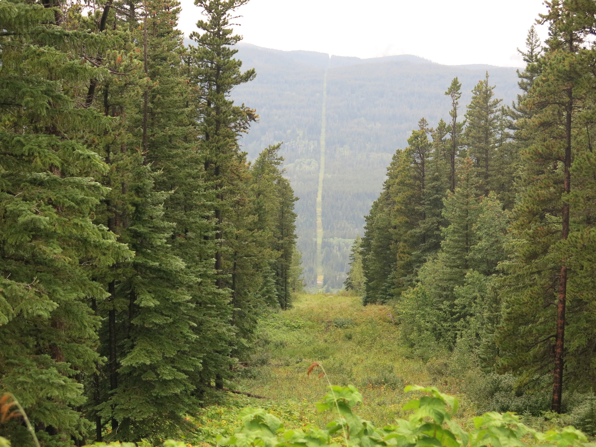
The International Boundary between the United States and Canada, at 5,525 miles, is the longest undefended border in the world. Since 1925, the International Boundary Commission, a joint organization led by the United States and Canada, has been responsible for surveying and mapping the boundary, as well as maintaining boundary monuments and keeping the border clear of vegetation and brush on either side of the dividing line. This “vista,” as it is often called, extends 20 feet in width, or 10 feet on either side of the border, for the entirety of the International Boundary regardless of the landscape it crosses. From the Alaska/Yukon to the New Brunswick border with Maine, this clear-cut swath can be seen stretching across prairies, through forest, over ridges and mountains, to the visible horizon.
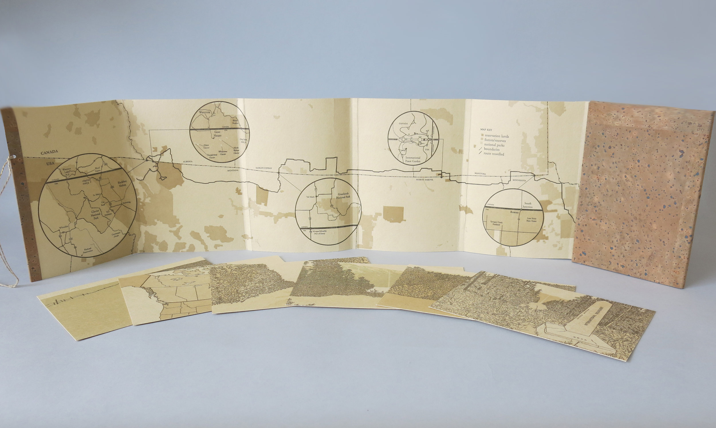
Towards a Just Landscape is a multi-part project about one particular section of this border, the 49th Parallel, as it physically marks the landscape between the Lake of the Woods and the Northern Rockies. More specifically, it is a project about the portion of the border swath that runs through the center of Waterton-Glacier International Peace Park, dividing in two an area of land reserved to commemorate international peace and good will between two nations. I first encountered the border swath on a boat excursion along Upper Waterton Lake in late summer, 2012. Over the next two years my curiosity with the border lingered, culminating in a research trip in 2014 that took me from my home in Iowa City, Iowa to the Alberta/Montana borderlands, skirting the 49th Parallel along the way.
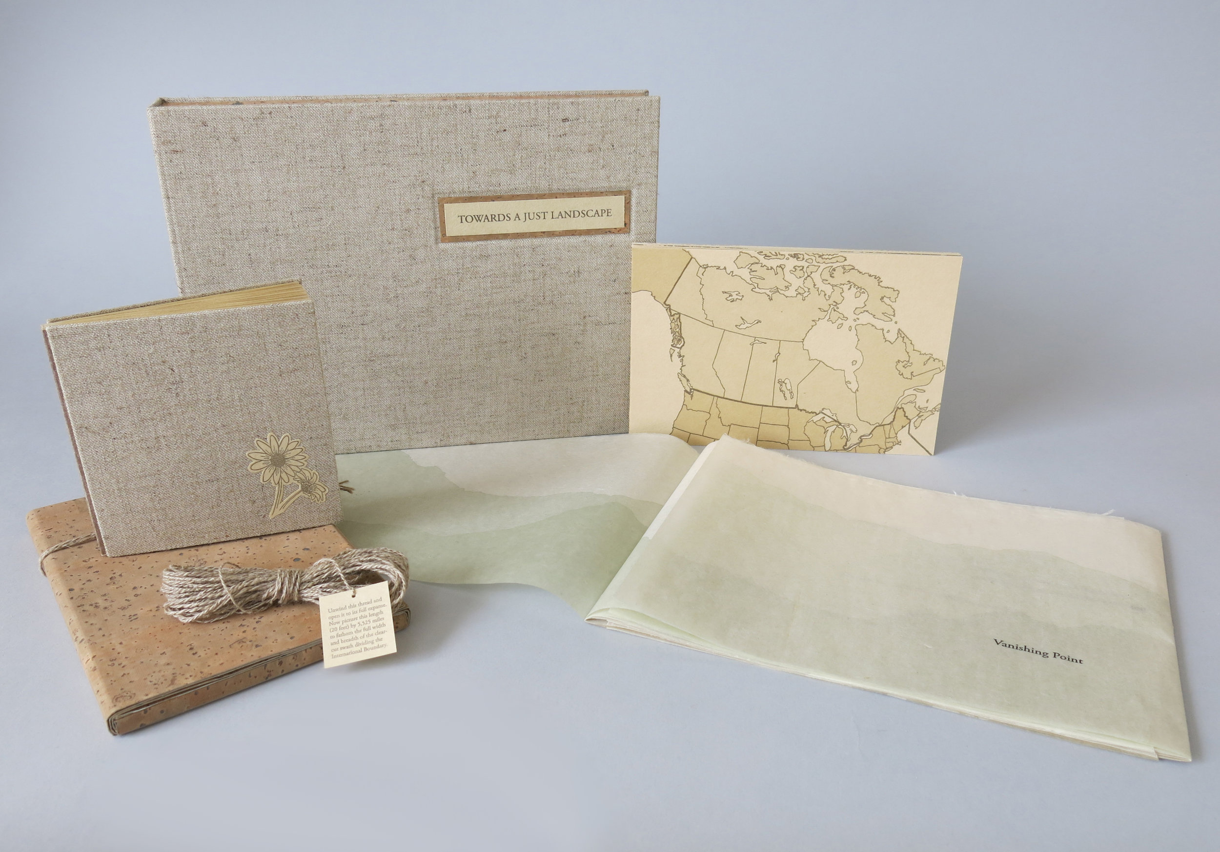
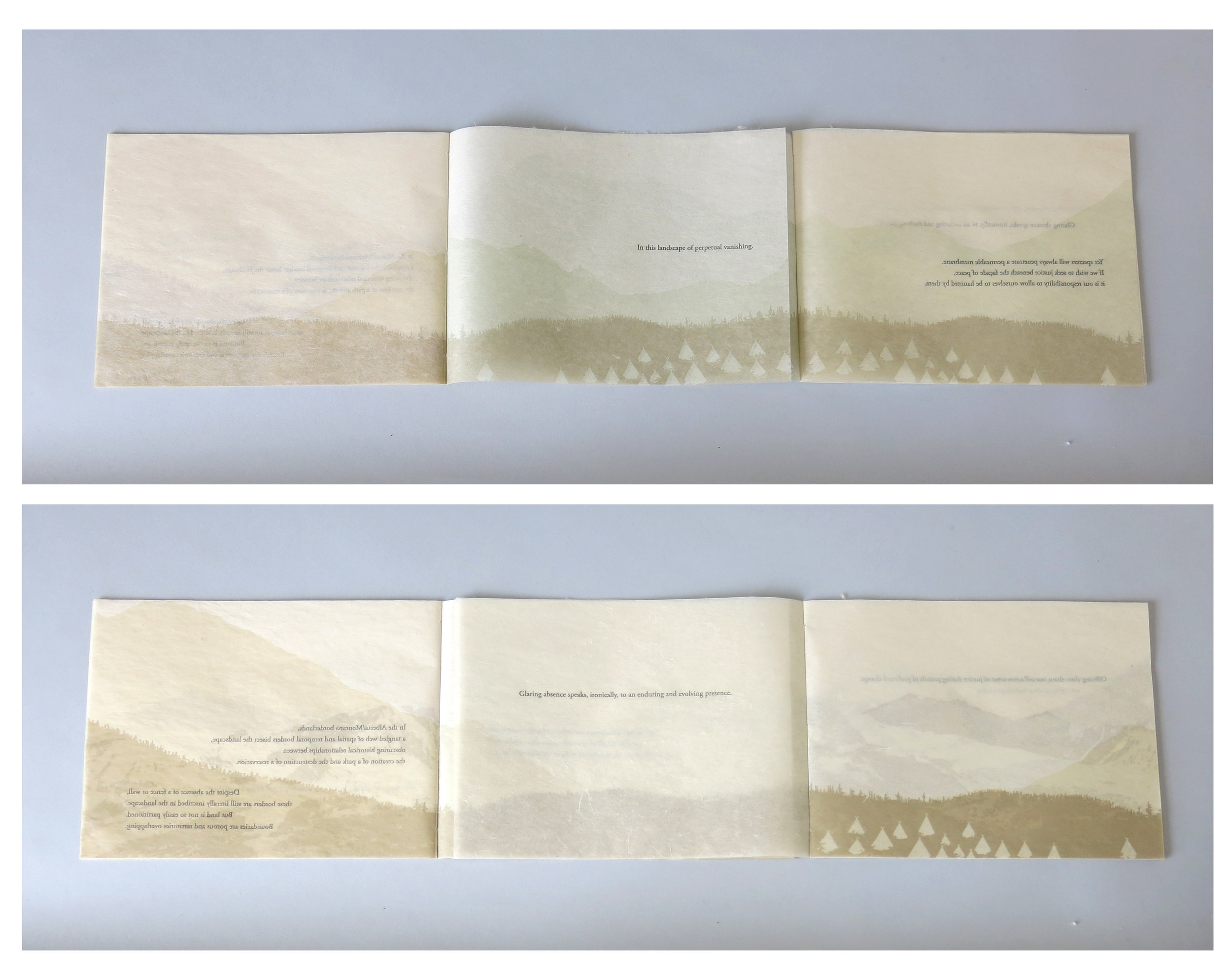
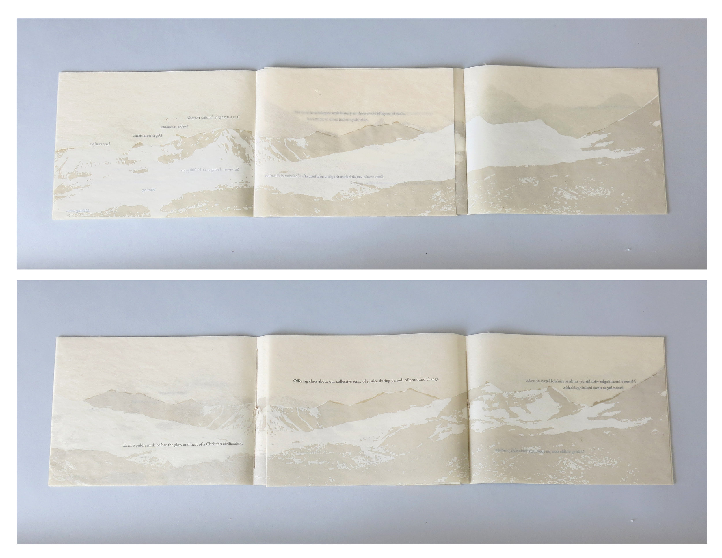
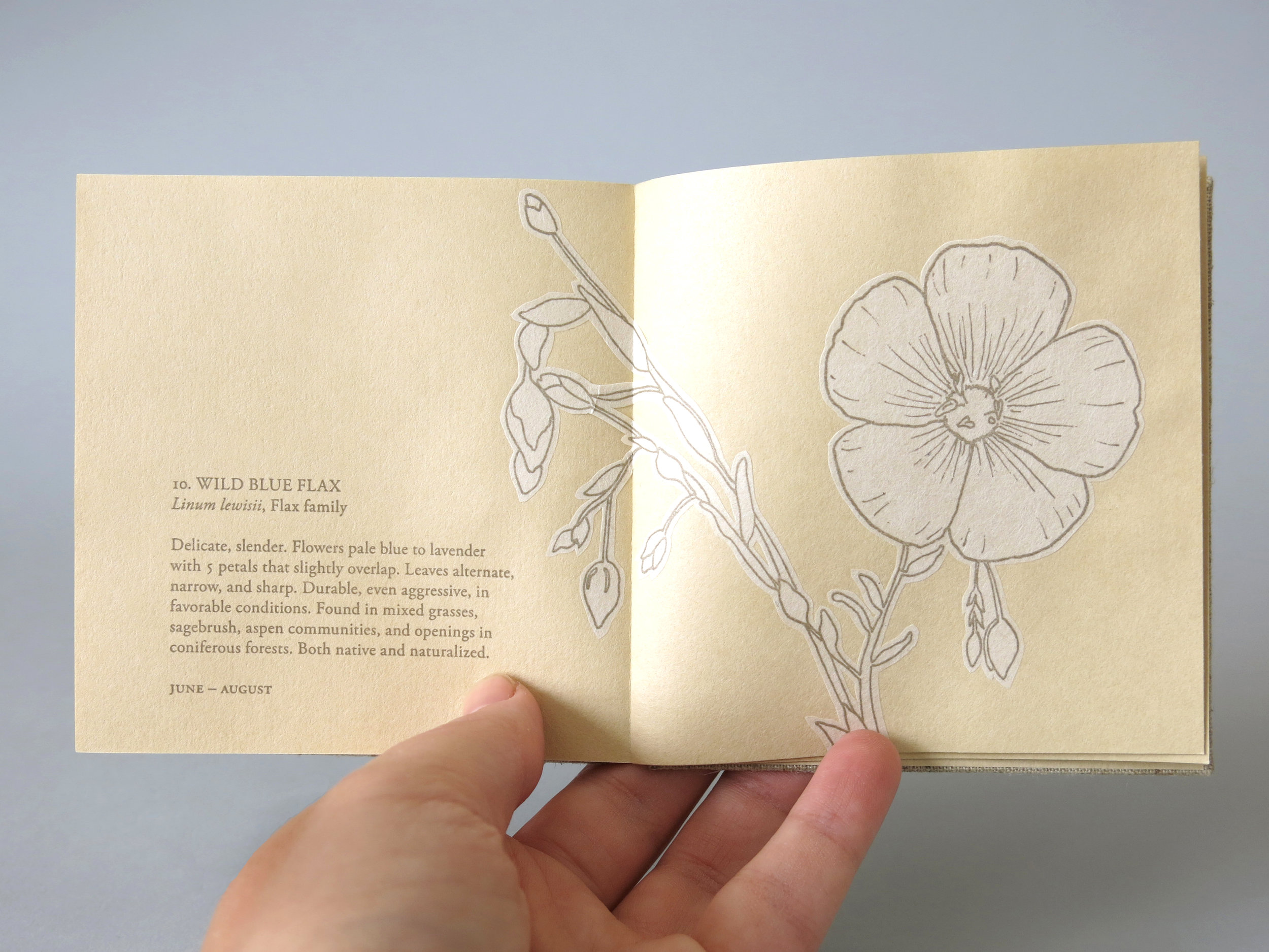
The resulting works that comprise Towards a Just Landscape each uniquely explore the political and ecological impact of the US/Canada border clearing on its surrounding environment. While Boundary Vistas studies the varying landscapes along the 49th Parallel at the macroscopic level to comment on the scale and enormity of the clear-cut, A Field Guide to New Growth, by contrast, focuses more microscopically on the swath itself and what can be found growing in the wake of destruction. Vanishing Point envisions the clear-cut as a physical representation of a deeper disconnect over how to achieve peace and justice in the Alberta/Montana borderlands. Together, these three works attempt to create a more complete picture of the physical border shared between the US and Canada as a means to re-imagine how borders are perceived so that we might work to create a more just landscape.
Letterpress printed on handmade gampi created by the artist, Sakamoto, and cork paper, with natural linen bookcloth and hand spun flax thread.
Edition of 15
2015
Out of print
DIMENSIONS
Box: 8.75 x 6.75 x 1" (closed); 18.25 x 6.75 x 1" (open)
Vanishing Point: 8 x 6" (closed); 23.5 x 6" (open)
Boundary Vistas: 4 x 6 x .25" (closed); 18.25 x 6 x .25" (open)
A Field Guide to New Growth: 3.75 x 4 x .25" (closed), 7.5 x 4 x .25" (open)
Thread: 20 feet
COLLECTIONS
Bowdoin College
Cal Poly SLO
Columbia University
Newberry Library
Penn State
RISD
UC Berkeley
UC Santa Cruz
University of Florida
University of Iowa
Wesleyan
Private collections